Nearby Croplands Increase Pesticide Exposure Risk in Iowa Schools
- Corn and soybeans account for about 99 percent of the planted acreage in Iowa, according to the U.S. Department of Agriculture.
- In recent years, Iowa farmers treated 95 percent of corn and soybean acres with pesticides and herbicides, notes an investigative report by IowaWatch.org.
- The Pesticide Bureau of the Iowa Department of Agriculture and Land Stewardship (IDALS) controls pesticide registration and applicator licensing, and investigates pesticide misuse complaints, including pesticide drift. The Bureau has records of 722 pesticide misuse complaints from 2012 to 2017 (through Aug. 1), according to its “Pesticide Drift – Frequently Asked Questions” document. The number is likely to be conservative, since the records reflect only reported cases. Most of the pesticide misuse cases reported in that period — 589 (81.6 percent) — are agriculture-related.
- “Forty-one states, including all of those in the agricultural Midwest, have no regulations requiring buffer zones around schools and day cares to protect young children from pesticide chemicals, should they accidentally drift off target from nearby crop fields,” explains an investigative report by the
Methodology
- M.H. Ward, et al (2006), in their research article, “Proximity to Crops and Residential Exposure to Agricultural Herbicides in Iowa” published in Environmental Health Perspectives, note “Rural residents can be exposed to agricultural pesticides through the proximity of their homes to crop fields.”
- They found that “Increasing acreage of corn and soybean fields within 750 m of homes was associated with significantly elevated odds of detecting agricultural herbicides compared with homes with no crops within 750 m,” and that “Herbicide concentrations also increased significantly with increasing acreage within 750 m.” Ward, et al. conclude that “Crop maps may be a useful method for estimating levels of herbicides in homes from nearby crop fields.”
- We applied the same research approach to school buildings. After all, drifting agricultural pesticides are unlikely to discriminate between houses and schools when the winds carry them.
- The distance of 750 meters (the standard used by Ward, et al.) equals 2460.63 feet. We conservatively used the distance of 2000 feet to calculate potentially harmful proximities of croplands to Iowa public school buildings.
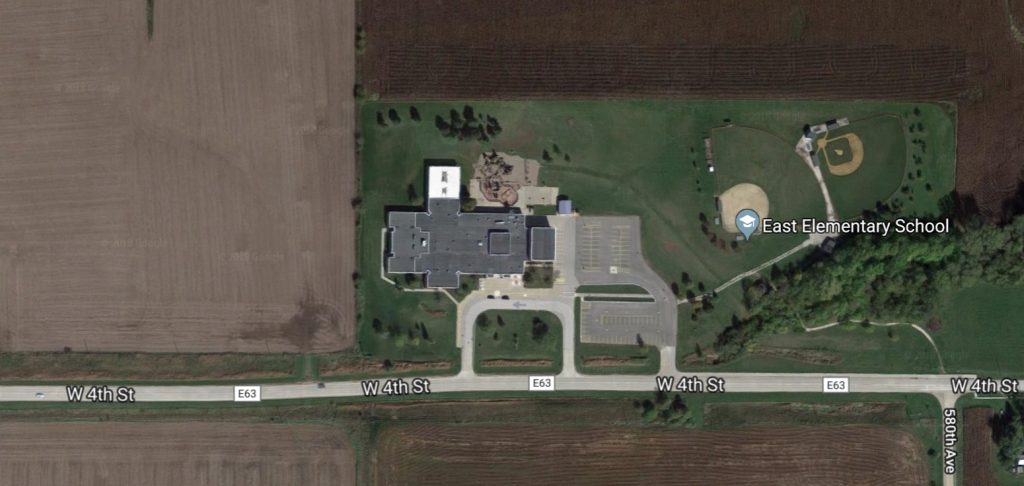
- Using Google maps, we mapped all 1321 PK-12 public school buildings in Iowa according to:
- their immediate adjacent proximity to crop fields (sharing a property line or across the street)
- their proximity within 2000 feet of crop fields.
Our Findings
- There are 1321 PK-12 public school buildings in Iowa and 333 public school districts, according to the 2017-2018 Iowa Public School Building Directory
- Iowa’s PK-12 public schools serve 485,147 students, and employ 36,412 full-time and part-time teachers.
- 33.5 percent of Iowa PK-12 public school buildings are adjacent to cropland—that is, they share a border, or are directly across the street from cropland. This means 148,042 students and teachers in Iowa attend and work in school buildings that are adjacent to cropland.
- 89.6 percent of Iowa PK-12 public school buildings (1183) are within 2000 feet of cropland. This means 444,559 students and teachers in Iowa attend and work in school buildings that are nearby (within 2000 feet of) cropland.
- The urban West Des Moines Community School District in Polk County is the only district of Iowa’s 333 public school districts that has no students in buildings adjacent to or within 2000 feet of cropland.
Data
[Click here for table with Google map links to all of Iowa’s 1321 PK-12 public school buildings.]
- Save as
- csv
Iowa Public Schools and Pesticide Spray Drift
Iowa's 333 school districts and their school building proximity to industrial croplands.
| County Name | District Name | District Certified Enrollment (total) | Total Contract Teachers | Total persons in district | Percent adjacent | Total persons adjacent | Percent within 2000ft | Total persons within 2000ft |
|---|---|---|---|---|---|---|---|---|
| Hardin | AGWSR Comm School District | 623 | 52 | 675 | 0 | 0 | 100 | 675 |
| Guthrie | Adair-Casey Comm School District | 300 | 36 | 336 | 100 | 336 | 100 | 336 |
| Dallas | Adel DeSoto Minburn Comm School District | 1655 | 130 | 1785 | 0 | 0 | 100 | 1785 |
| Plymouth | Akron Westfield Comm School District | 520 | 51 | 571 | 100 | 571 | 100 | 571 |
| Buena Vista | Albert City-Truesdale Comm School District | 203 | 14 | 217 | 0 | 0 | 100 | 217 |
| Monroe | Albia Comm School District | 1216 | 85 | 1301 | 0 | 0 | 100 | 1301 |
| Linn | Alburnett Comm School District | 515 | 48 | 563 | 0 | 0 | 100 | 563 |
| Hardin | Alden Comm School District | 282 | 27 | 309 | 0 | 0 | 100 | 309 |
| Kossuth | Algona Comm School District | 1328 | 98 | 1426 | 68 | 970 | 100 | 1426 |
| Allamakee | Allamakee Comm School District | 1105 | 77 | 1182 | 75 | 886 | 100 | 1182 |
| Butler | North Butler Comm School District | 592 | 54 | 646 | 100 | 646 | 100 | 646 |
| Buena Vista | Alta Comm School District | 517 | 58 | 575 | 100 | 575 | 100 | 575 |
| Story | Ames Comm School District | 4188 | 318 | 4506 | 52 | 2343 | 100 | 4506 |
| Jones | Anamosa Comm School District | 1258 | 97 | 1355 | 100 | 1355 | 100 | 1355 |
| Jackson | Andrew Comm School District | 234 | 18 | 252 | 100 | 252 | 100 | 252 |
| Polk | Ankeny Comm School District | 11193 | 665 | 11858 | 6 | 711 | 100 | 11858 |
| Butler | Aplington-Parkersburg Comm School District | 847 | 73 | 920 | 0 | 0 | 100 | 920 |
| Emmet | North Union Comm School District | 421 | 36 | 457 | 52 | 238 | 100 | 457 |
| Crawford | Ar-We-Va Comm School District | 286 | 20 | 306 | 0 | 0 | 100 | 306 |
| Cass | Atlantic Comm School District | 1385 | 109 | 1494 | 32 | 478 | 100 | 1494 |
| Audubon | Audubon Comm School District | 502 | 46 | 548 | 64 | 351 | 100 | 548 |
| Cherokee | Aurelia Comm School District | 237 | 34 | 271 | 0 | 0 | 100 | 271 |
| Pottawattamie | AHSTW Comm School District | 778 | 62 | 840 | 100 | 840 | 100 | 840 |
| Story | Ballard Comm School District | 1604 | 121 | 1725 | 75 | 1294 | 100 | 1725 |
| Ida | Battle Creek-Ida Grove Comm School District | 642 | 66 | 708 | 39 | 276 | 100 | 708 |
| Jasper | Baxter Comm School District | 329 | 35 | 364 | 0 | 0 | 100 | 364 |
| Grundy | BCLUW Comm School District | 555 | 47 | 602 | 68 | 410 | 100 | 602 |
| Taylor | Bedford Comm School District | 445 | 42 | 487 | 0 | 0 | 100 | 487 |
| Benton | Belle Plaine Comm School District | 531 | 42 | 573 | 49 | 281 | 100 | 573 |
| Jackson | Bellevue Comm School District | 574 | 46 | 620 | 69 | 428 | 100 | 620 |
| Wright | Belmond-Klemme Comm School District | 812 | 54 | 866 | 100 | 866 | 100 | 866 |
| Cedar | Bennett Comm School District | 186 | 14 | 200 | 100 | 200 | 100 | 200 |
| Benton | Benton Comm School District | 1515 | 104 | 1619 | 24 | 389 | 100 | 1619 |
| Scott | Bettendorf Comm School District | 4134 | 297 | 4431 | 0 | 0 | 38 | 1684 |
| Wapello | Eddyville-Blakesburg- Fremont CSD | 887 | 79 | 966 | 63 | 609 | 100 | 966 |
| Polk | Bondurant-Farrar Comm School District | 1916 | 133 | 2049 | 25 | 512 | 100 | 2049 |
| Boone | Boone Comm School District | 2048 | 156 | 2204 | 30 | 661 | 100 | 2204 |
| Sioux | Boyden-Hull Comm School District | 604 | 49 | 653 | 0 | 0 | 100 | 653 |
| Hancock | West Hancock Comm School District | 565 | 50 | 615 | 100 | 615 | 100 | 615 |
| Poweshiek | Brooklyn-Guernsey-Malcom Comm School District | 527 | 45 | 572 | 100 | 572 | 100 | 572 |
| Winnebago | North Iowa Comm School District | 477 | 42 | 519 | 0 | 0 | 100 | 519 |
| Des Moines | Burlington Comm School District | 4423 | 294 | 4717 | 11 | 519 | 100 | 4717 |
| Cass | CAM Comm School District | 488 | 63 | 551 | 27 | 149 | 100 | 551 |
| Franklin | CAL Comm School District | 261 | 32 | 293 | 100 | 293 | 100 | 293 |
| Clinton | Calamus-Wheatland Comm School District | 449 | 43 | 492 | 100 | 492 | 100 | 492 |
| Clinton | Camanche Comm School District | 861 | 78 | 939 | 45 | 423 | 100 | 939 |
| Wapello | Cardinal Comm School District | 568 | 52 | 620 | 100 | 620 | 100 | 620 |
| Warren | Carlisle Comm School District | 1902 | 134 | 2036 | 0 | 0 | 100 | 2036 |
| Carroll | Carroll Comm School District | 1679 | 120 | 1799 | 65 | 1169 | 100 | 1799 |
| Black Hawk | Cedar Falls Comm School District | 5147 | 381 | 5528 | 0 | 0 | 88 | 4864 |
| Linn | Cedar Rapids Comm School District | 17092 | 381 | 17473 | 4 | 699 | 54 | 9435 |
| Linn | Center Point-Urbana Comm School District | 1364 | 107 | 1471 | 32 | 471 | 100 | 1471 |
| Appanoose | Centerville Comm School District | 1336 | 109 | 1445 | 0 | 0 | 100 | 1445 |
| Lee | Central Lee Comm School District | 787 | 74 | 861 | 100 | 861 | 100 | 861 |
| Clayton | Central Comm School District | 433 | 37 | 470 | 0 | 0 | 100 | 470 |
| Clinton | Central DeWitt School District | 1463 | 121 | 1584 | 69 | 1093 | 100 | 1584 |
| Linn | Central City Comm School District | 479 | 40 | 519 | 0 | 0 | 100 | 519 |
| Decatur | Central Decatur Comm School District | 651 | 40 | 691 | 61 | 421 | 100 | 691 |
| Lyon | Central Lyon Comm School District | 751 | 62 | 813 | 0 | 0 | 100 | 813 |
| Lucas | Chariton Comm School District | 1282 | 95 | 1377 | 0 | 0 | 100 | 1377 |
| Floyd | Charles City Comm School District | 1513 | 111 | 1624 | 0 | 0 | 100 | 1624 |
| Crawford | Charter Oak-Ute Comm School District | 271 | 31 | 302 | 0 | 0 | 100 | 302 |
| Cherokee | Cherokee Comm School District | 943 | 76 | 1019 | 0 | 0 | 100 | 1019 |
| Page | Clarinda Comm School District | 961 | 83 | 1044 | 36 | 376 | 100 | 1044 |
| Wright | Clarion-Goldfield-Dows Comm School District | 967 | 68 | 1035 | 33 | 341 | 100 | 1035 |
| Clarke | Clarke Comm School District | 1417 | 110 | 1527 | 0 | 0 | 100 | 1527 |
| Butler | Clarksville Comm School District | 326 | 30 | 356 | 100 | 356 | 100 | 356 |
| Clay | Clay Central-Everly Comm School District | 348 | 27 | 375 | 0 | 0 | 100 | 375 |
| Johnson | Clear Creek Amana Comm School District | 2005 | 174 | 2179 | 59 | 1285 | 100 | 2179 |
| Cerro Gordo | Clear Lake Comm School District | 1220 | 99 | 1319 | 0 | 0 | 100 | 1319 |
| Clinton | Clinton Comm School District | 3785 | 280 | 4065 | 10 | 406 | 100 | 4065 |
| Jasper | Colfax-Mingo Comm School District | 722 | 54 | 776 | 0 | 0 | 100 | 776 |
| Linn | College Comm School District | 5087 | 369 | 5456 | 100 | 5456 | 100 | 5456 |
| Story | Collins-Maxwell Comm School District | 488 | 41 | 529 | 44 | 233 | 100 | 529 |
| Story | Colo-NESCO Comm School District | 508 | 38 | 546 | 100 | 546 | 100 | 546 |
| Louisa | Columbus Comm School District | 797 | 62 | 859 | 0 | 0 | 100 | 859 |
| Carroll | Coon Rapids-Bayard Comm School District | 424 | 39 | 463 | 100 | 463 | 100 | 463 |
| Adams | Corning Comm School District | 422 | 42 | 464 | 0 | 0 | 100 | 464 |
| Pottawattamie | Council Bluffs Comm School District | 9257 | 617 | 9874 | 0 | 0 | 33 | 3258 |
| Union | Creston Comm School District | 1456 | 120 | 1576 | 76 | 1198 | 100 | 1576 |
| Dallas | Dallas Center-Grimes Comm School District | 2690 | 194 | 2884 | 53 | 1529 | 100 | 2884 |
| Des Moines | Danville Comm School District | 508 | 48 | 556 | 100 | 556 | 100 | 556 |
| Scott | Davenport Comm School District | 15490 | 1275 | 16765 | 4 | 671 | 63 | 10562 |
| Davis | Davis County Comm School District | 1183 | 93 | 1276 | 0 | 0 | 100 | 1276 |
| Winneshiek | Decorah Community School District | 1349 | 124 | 1473 | 0 | 0 | 100 | 1473 |
| Clinton | Delwood Comm School District | 192 | 15 | 207 | 100 | 207 | 100 | 207 |
| Crawford | Denison Comm School District | 2064 | 150 | 2214 | 60 | 1328 | 100 | 2214 |
| Bremer | Denver Comm School District | 716 | 55 | 771 | 0 | 0 | 100 | 771 |
| Polk | Des Moines Independent Comm School District | 32979 | 2466 | 35445 | 0 | 0 | 23 | 8152 |
| Ringgold | Diagonal Comm School District | 100 | 14 | 114 | 100 | 114 | 100 | 114 |
| Grundy | Dike-New Hartford Comm School District | 885 | 74 | 959 | 0 | 0 | 100 | 959 |
| Dubuque | Dubuque Comm School District | 10556 | 821 | 11377 | 0 | 0 | 59 | 6712 |
| Black Hawk | Dunkerton Comm School District | 419 | 45 | 464 | 0 | 0 | 100 | 464 |
| Harrison | Boyer Valley Comm School District | 416 | 45 | 461 | 0 | 0 | 100 | 461 |
| Cedar | Durant Comm School District | 581 | 51 | 632 | 100 | 632 | 100 | 632 |
| Wright | Eagle Grove Comm School District | 852 | 69 | 921 | 0 | 0 | 100 | 921 |
| Madison | Earlham Comm School District | 579 | 69 | 648 | 0 | 0 | 100 | 648 |
| Buchanan | East Buchanan Comm School District | 583 | 47 | 630 | 100 | 630 | 100 | 630 |
| Jackson | Easton Valley Comm School District | 616 | 42 | 658 | 0 | 0 | 100 | 658 |
| Marshall | East Marshall Comm School District | 554 | 70 | 624 | 100 | 624 | 100 | 624 |
| Union | East Union Comm School District | 493 | 43 | 536 | 100 | 536 | 100 | 536 |
| Allamakee | Eastern Allamakee Comm School District | 344 | 33 | 377 | 0 | 0 | 100 | 377 |
| Woodbury | River Valley Comm School District | 431 | 39 | 470 | 31 | 146 | 100 | 470 |
| Delaware | Edgewood-Colesburg Comm School District | 385 | 47 | 432 | 100 | 432 | 100 | 432 |
| Hardin | Eldora-New Providence Comm School District | 634 | 53 | 687 | 35 | 240 | 100 | 687 |
| Palo Alto | Emmetsburg Comm School District | 698 | 64 | 762 | 0 | 0 | 100 | 762 |
| Iowa | English Valleys Comm School District | 458 | 43 | 501 | 52 | 260 | 100 | 501 |
| Page | Essex Comm School District | 196 | 28 | 224 | 100 | 224 | 100 | 224 |
| Emmet | Estherville Lincoln Central Com Sch Dist | 1377 | 104 | 1481 | 0 | 0 | 100 | 1481 |
| Shelby | Exira-Elk Horn- Kimballton Comm Sch Dist | 443 | 44 | 487 | 0 | 0 | 100 | 487 |
| Jefferson | Fairfield Comm School District | 1637 | 123 | 1760 | 0 | 0 | 100 | 1760 |
| Winnebago | Forest City Comm School District | 1105 | 91 | 1196 | 0 | 0 | 100 | 1196 |
| Webster | Fort Dodge Comm School District | 3711 | 261 | 3972 | 33 | 1311 | 100 | 3972 |
| Lee | Fort Madison Comm School District | 2141 | 145 | 2286 | 37 | 846 | 100 | 2286 |
| Fremont | Fremont-Mills Comm School District | 456 | 43 | 499 | 100 | 499 | 100 | 499 |
| Ida | Galva-Holstein Comm School District | 427 | 44 | 471 | 20 | 94 | 100 | 471 |
| Hancock | Garner-Hayfield-Ventura Comm School District | 879 | 84 | 963 | 45 | 433 | 100 | 963 |
| Lyon | George-Little Rock Comm School District | 459 | 40 | 499 | 50 | 250 | 100 | 499 |
| Story | Gilbert Comm School District | 1425 | 104 | 1529 | 79 | 1208 | 100 | 1529 |
| Humboldt | Gilmore City-Bradgate Comm School District | 118 | 10 | 128 | 100 | 128 | 100 | 128 |
| Grundy | Gladbrook-Reinbeck Comm School District | 569 | 48 | 617 | 0 | 0 | 100 | 617 |
| Mills | Glenwood Comm School District | 1957 | 135 | 2092 | 0 | 0 | 100 | 2092 |
| Carroll | Glidden-Ralston Comm School District | 267 | 135 | 402 | 0 | 0 | 100 | 402 |
| Palo Alto | Graettinger-Terril Comm School District | 376 | 41 | 417 | 0 | 0 | 100 | 417 |
| Adair | Nodaway Valley Comm School District | 664 | 53 | 717 | 30 | 215 | 100 | 717 |
| Tama | GMG Comm School District | 287 | 41 | 328 | 16 | 53 | 100 | 328 |
| Poweshiek | Grinnell-Newburg Comm School District | 1615 | 129 | 1744 | 67 | 1168 | 100 | 1744 |
| Cass | Griswold Comm School District | 517 | 46 | 563 | 59 | 332 | 100 | 563 |
| Grundy | Grundy Center Comm School District | 659 | 62 | 721 | 0 | 0 | 100 | 721 |
| Guthrie | Guthrie Center Comm School District | 463 | 64 | 527 | 37 | 195 | 100 | 527 |
| Clayton | Clayton Ridge Comm School District | 577 | 62 | 639 | 30 | 192 | 100 | 639 |
| Iowa | H-L-V Comm School District | 331 | 29 | 360 | 0 | 0 | 100 | 360 |
| Iowa | Hamburg Comm School District | 235 | 18 | 253 | 0 | 0 | 100 | 253 |
| Franklin | Hampton-Dumont Comm School District | 1192 | 108 | 1300 | 61 | 793 | 100 | 1300 |
| Shelby | Harlan Comm School District | 1399 | 107 | 1506 | 76 | 1145 | 100 | 1506 |
| Van Buren | Harmony Comm School District | 346 | 20 | 366 | 100 | 366 | 100 | 366 |
| Dickinson | Harris-Lake Park Comm School District | 300 | 31 | 331 | 65 | 215 | 100 | 331 |
| O'Brien | Hartley-Melvin-Sanborn Comm School District | 638 | 57 | 695 | 33 | 229 | 100 | 695 |
| Washington | Highland Comm School District | 629 | 57 | 686 | 100 | 686 | 100 | 686 |
| Plymouth | Hinton Comm School District | 538 | 55 | 593 | 100 | 593 | 100 | 593 |
| Howard | Howard-Winneshiek Comm School District | 1195 | 83 | 1278 | 0 | 0 | 100 | 1278 |
| Hardin | Hubbard-Radcliffe Comm School District | 460 | 37 | 497 | 52 | 258 | 100 | 497 |
| Black Hawk | Hudson Comm School District | 666 | 56 | 722 | 0 | 0 | 100 | 722 |
| Humboldt | Humboldt Comm School District | 1198 | 100 | 1298 | 80 | 1038 | 100 | 1298 |
| Buchanan | Independence Comm School District | 1412 | 107 | 1519 | 72 | 1094 | 100 | 1519 |
| Warren | Indianola Comm School District | 3429 | 230 | 3659 | 44 | 1610 | 100 | 3659 |
| Madison | Interstate 35 Comm School District | 888 | 66 | 954 | 100 | 954 | 100 | 954 |
| Johnson | Iowa City Comm School District | 13982 | 934 | 14916 | 14 | 2088 | 96 | 14319 |
| Hardin | Iowa Falls Comm School District | 1079 | 98 | 1177 | 42 | 494 | 100 | 1177 |
| Iowa | Iowa Valley Comm School District | 541 | 45 | 586 | 0 | 0 | 100 | 586 |
| Carroll | IKM-Manning Comm School District | 659 | 51 | 710 | 100 | 710 | 100 | 710 |
| Iowa | Janesville Consolidated School District | 389 | 51 | 440 | 100 | 440 | 100 | 440 |
| Greene | Greene County Comm School District | 1248 | 106 | 1354 | 0 | 0 | 100 | 1354 |
| Buchanan | Jesup Comm School District | 886 | 71 | 957 | 100 | 957 | 100 | 957 |
| Polk | Johnston Comm School District | 6894 | 431 | 7325 | 24 | 1758 | 100 | 7325 |
| Lee | Keokuk Comm School District | 1914 | 135 | 2049 | 0 | 0 | 100 | 2049 |
| Keokuk | Keota Comm School District | 349 | 32 | 381 | 100 | 381 | 100 | 381 |
| Plymouth | Kingsley-Pierson Comm School District | 467 | 41 | 508 | 93 | 473 | 100 | 508 |
| Marion | Knoxville Comm School District | 1745 | 118 | 1863 | 0 | 0 | 100 | 1863 |
| Winnebago | Lake Mills Comm School District | 615 | 56 | 671 | 0 | 0 | 100 | 671 |
| Decatur | Lamoni Comm School District | 300 | 32 | 332 | 0 | 0 | 100 | 332 |
| Pocahontas | Laurens-Marathon Comm School District | 291 | 25 | 316 | 0 | 0 | 100 | 316 |
| Woodbury | Lawton-Bronson Comm School District | 582 | 50 | 632 | 0 | 0 | 100 | 632 |
| Plymouth | Le Mars Comm School District | 2170 | 137 | 2307 | 0 | 0 | 100 | 2307 |
| Taylor | Lenox Comm School District | 467 | 49 | 516 | 100 | 516 | 100 | 516 |
| Pottawattamie | Lewis Central Comm School District | 2495 | 194 | 2689 | 61 | 1640 | 100 | 2689 |
| Iowa | North Cedar Comm School District | 824 | 61 | 885 | 34 | 301 | 100 | 885 |
| Linn | Linn-Mar Comm School District | 7313 | 478 | 7791 | 16 | 1246 | 93 | 7245 |
| Linn | Lisbon Comm School District | 663 | 48 | 711 | 0 | 0 | 100 | 711 |
| Harrison | Logan-Magnolia Comm School District | 552 | 55 | 607 | 100 | 607 | 100 | 607 |
| Johnson | Lone Tree Comm School District | 360 | 41 | 401 | 100 | 401 | 100 | 401 |
| Louisa | Louisa-Muscatine Comm School District | 730 | 67 | 797 | 100 | 797 | 100 | 797 |
| Kossuth | LuVerne Comm School District | 154 | 12 | 166 | 100 | 166 | 100 | 166 |
| Jasper | Lynnville-Sully Comm School District | 452 | 42 | 494 | 100 | 494 | 100 | 494 |
| Boone | Madrid Comm School District | 673 | 56 | 729 | 39 | 284 | 100 | 729 |
| Mills | East Mills Comm School District | 534 | 43 | 577 | 100 | 577 | 100 | 577 |
| Calhoun | Manson Northwest Webster Comm School District | 649 | 59 | 708 | 49 | 347 | 100 | 708 |
| Monona | Maple Valley-Anthon Oto Comm School District | 679 | 56 | 735 | 0 | 0 | 100 | 735 |
| Jackson | Maquoketa Comm School District | 1364 | 118 | 1482 | 25 | 370 | 100 | 1482 |
| Delaware | Maquoketa Valley Comm School District | 698 | 51 | 749 | 68 | 510 | 100 | 749 |
| Cherokee | Marcus-Meriden-Cleghorn Comm School District | 431 | 34 | 465 | 57 | 265 | 100 | 465 |
| Linn | Marion Independent School District | 1935 | 182 | 2117 | 0 | 0 | 100 | 2117 |
| Marshall | Marshalltown Comm School District | 5435 | 370 | 5805 | 0 | 0 | 100 | 5805 |
| Warren | Martensdale-St Marys Comm School District | 510 | 45 | 555 | 0 | 0 | 100 | 555 |
| Cerro Gordo | Mason City Comm School District | 3742 | 270 | 4012 | 13 | 522 | 100 | 4012 |
| Sioux | MOC-Floyd Valley Comm School District | 1412 | 114 | 1526 | 0 | 0 | 100 | 1526 |
| Des Moines | Mediapolis Comm School District | 781 | 63 | 844 | 100 | 844 | 100 | 844 |
| Marion | Melcher-Dallas Comm School District | 343 | 34 | 377 | 0 | 0 | 100 | 377 |
| Jones | Midland Comm School District | 553 | 40 | 593 | 50 | 296 | 100 | 593 |
| Washington | Mid-Prairie Comm School District | 1258 | 109 | 1367 | 54 | 738 | 100 | 1367 |
| Harrison | Missouri Valley Comm School District | 842 | 64 | 906 | 55 | 498 | 100 | 906 |
| Clayton | MFL MarMac Comm School District | 777 | 61 | 838 | 0 | 0 | 100 | 838 |
| Poweshiek | Montezuma Comm School District | 526 | 44 | 570 | 100 | 570 | 100 | 570 |
| Jones | Monticello Comm School District | 1026 | 82 | 1108 | 40 | 443 | 100 | 1108 |
| Appanoose | Moravia Comm School District | 330 | 39 | 369 | 100 | 369 | 100 | 369 |
| Decatur | Mormon Trail Comm School District | 258 | 29 | 287 | 43 | 124 | 100 | 287 |
| Louisa | Morning Sun Comm School District | 213 | 13 | 226 | 0 | 0 | 100 | 226 |
| Appanoose | Moulton-Udell Comm School District | 223 | 21 | 244 | 100 | 244 | 100 | 244 |
| Ringgold | Mount Ayr Comm School District | 633 | 58 | 691 | 48 | 332 | 100 | 691 |
| Henry | Mount Pleasant Comm School District | 1970 | 159 | 2129 | 32 | 681 | 100 | 2129 |
| Linn | Mount Vernon Comm School District | 1124 | 95 | 1219 | 100 | 1219 | 100 | 1219 |
| Clarke | Murray Comm School District | 264 | 39 | 303 | 0 | 0 | 100 | 303 |
| Muscatine | Muscatine Comm School District | 5084 | 408 | 5492 | 0 | 0 | 88 | 4833 |
| Chickasaw | Nashua-Plainfield Comm School District | 623 | 46 | 669 | 49 | 328 | 100 | 669 |
| Story | Nevada Comm School District | 1548 | 115 | 1663 | 0 | 0 | 100 | 1663 |
| Buena Vista | Newell-Fonda Comm School District | 471 | 47 | 518 | 0 | 0 | 100 | 518 |
| Chickasaw | New Hampton Comm School District | 963 | 83 | 1046 | 37 | 387 | 100 | 1046 |
| Henry | New London Comm School District | 492 | 47 | 539 | 0 | 0 | 100 | 539 |
| Jasper | Newton Comm School District | 2965 | 214 | 3179 | 45 | 1431 | 100 | 3179 |
| Worth | Central Springs Comm School District | 814 | 58 | 872 | 100 | 872 | 100 | 872 |
| Clinton | Northeast Comm School District | 525 | 68 | 593 | 100 | 593 | 100 | 593 |
| Fayette | North Fayette Comm School District | 754 | 79 | 833 | 85 | 708 | 100 | 833 |
| Hamilton | Northeast Hamilton Comm School District | 195 | 14 | 209 | 100 | 209 | 100 | 209 |
| Mahaska | North Mahaska Comm School District | 510 | 44 | 554 | 100 | 554 | 100 | 554 |
| Linn | North Linn Comm School District | 641 | 48 | 689 | 100 | 689 | 100 | 689 |
| Kossuth | North Kossuth Comm School District | 262 | 31 | 293 | 100 | 293 | 100 | 293 |
| Polk | North Polk Comm School District | 1565 | 108 | 1673 | 26 | 435 | 100 | 1673 |
| Scott | North Scott Comm School District | 3062 | 223 | 3285 | 31 | 1018 | 100 | 3285 |
| Tama | North Tama County Comm School District | 441 | 44 | 485 | 0 | 0 | 100 | 485 |
| Winneshiek | North Winneshiek Comm School District | 283 | 16 | 299 | 100 | 299 | 100 | 299 |
| Worth | Northwood-Kensett Comm School District | 500 | 43 | 543 | 0 | 0 | 100 | 543 |
| Warren | Norwalk Comm School District | 2715 | 199 | 2914 | 55 | 1602 | 100 | 2914 |
| Sac | Odebolt-Arthur Comm School District | 334 | 39 | 373 | 0 | 0 | 100 | 373 |
| Fayette | Oelwein Comm School District | 1282 | 97 | 1379 | 32 | 441 | 100 | 1379 |
| Boone | Ogden Comm School District | 631 | 63 | 694 | 40 | 277 | 100 | 694 |
| Dickinson | Okoboji Comm School District | 974 | 82 | 1056 | 0 | 0 | 100 | 1056 |
| Jones | Olin Consolidated School District | 218 | 14 | 232 | 0 | 0 | 100 | 232 |
| Adair | Orient-Macksburg Comm School District | 192 | 19 | 211 | 100 | 211 | 100 | 211 |
| Mitchell | Osage Comm School District | 921 | 71 | 992 | 0 | 0 | 100 | 992 |
| Mahaska | Oskaloosa Comm School District | 2365 | 160 | 2525 | 95 | 2399 | 100 | 2525 |
| Wapello | Ottumwa Comm School District | 4643 | 311 | 4954 | 17 | 842 | 71 | 3517 |
| Guthrie | Panorama Comm School District | 723 | 56 | 779 | 100 | 779 | 100 | 779 |
| Greene | Paton-Churdan Comm School District | 194 | 20 | 214 | 100 | 214 | 100 | 214 |
| Jasper | PCM Comm School District | 1047 | 83 | 1130 | 29 | 328 | 100 | 1130 |
| Jefferson | Pekin Comm School District | 616 | 49 | 665 | 100 | 665 | 100 | 665 |
| Marion | Pella Comm School District | 2158 | 159 | 2317 | 50 | 1158 | 100 | 2317 |
| Dallas | Perry Comm School District | 1835 | 134 | 1969 | 0 | 0 | 100 | 1969 |
| Scott | Pleasant Valley Comm School District | 4746 | 303 | 5049 | 22 | 1111 | 100 | 5049 |
| Marion | Pleasantville Comm School District | 694 | 59 | 753 | 0 | 0 | 100 | 753 |
| Pocahontas | Pocahontas Area Comm School District | 695 | 58 | 753 | 0 | 0 | 100 | 753 |
| Allamakee | Postville Comm School District | 702 | 68 | 770 | 100 | 770 | 100 | 770 |
| Webster | Prairie Valley Comm School District | 590 | 46 | 636 | 41 | 261 | 100 | 636 |
| Montgomery | Red Oak Comm School District | 1110 | 91 | 1201 | 0 | 0 | 100 | 1201 |
| Plymouth | Remsen-Union Comm School District | 367 | 37 | 404 | 100 | 404 | 100 | 404 |
| Howard | Riceville Comm School District | 303 | 32 | 335 | 0 | 0 | 100 | 335 |
| Pottawattamie | Riverside Comm School District | 704 | 52 | 756 | 59 | 446 | 100 | 756 |
| Sioux | Rock Valley Comm School District | 785 | 63 | 848 | 100 | 848 | 100 | 848 |
| Story | Roland-Story Comm School District | 1015 | 71 | 1086 | 0 | 0 | 100 | 1086 |
| Floyd | Rudd-Rockford-Marble Rk Comm School District | 441 | 38 | 479 | 100 | 479 | 100 | 479 |
| Palo Alto | Ruthven-Ayrshire Comm School District | 229 | 23 | 252 | 0 | 0 | 100 | 252 |
| Mitchell | St Ansgar Comm School District | 600 | 44 | 644 | 100 | 644 | 100 | 644 |
| Polk | Saydel Comm School District | 1123 | 99 | 1222 | 0 | 0 | 100 | 1222 |
| Sac | Schaller-Crestland Comm School District | 354 | 37 | 391 | 0 | 0 | 100 | 391 |
| Crawford | Schleswig Comm School District | 274 | 18 | 292 | 100 | 292 | 100 | 292 |
| Woodbury | Sergeant Bluff-Luton Comm School District | 1422 | 110 | 1532 | 0 | 0 | 100 | 1532 |
| Wayne | Seymour Comm School District | 300 | 30 | 330 | 0 | 0 | 100 | 330 |
| Franklin | West Fork CSD | 703 | 59 | 762 | 0 | 0 | 100 | 762 |
| O'Brien | Sheldon Comm School District | 1048 | 75 | 1123 | 0 | 0 | 100 | 1123 |
| Page | Shenandoah Comm School District | 1076 | 87 | 1163 | 100 | 1163 | 100 | 1163 |
| Osceola | Sibley-Ocheyedan Comm School District | 766 | 61 | 827 | 0 | 0 | 100 | 827 |
| Fremont | Sidney Comm School District | 409 | 61 | 470 | 46 | 216 | 100 | 470 |
| Keokuk | Sigourney Comm School District | 537 | 43 | 580 | 36 | 209 | 100 | 580 |
| Sioux | Sioux Center Comm School District | 1245 | 105 | 1350 | 44 | 594 | 100 | 1350 |
| Buena Vista | Sioux Central Comm School District | 473 | 55 | 528 | 100 | 528 | 100 | 528 |
| Woodbury | Sioux City Comm School District | 14504 | 924 | 15428 | 12 | 1851 | 94 | 14502 |
| Calhoun | South Central Calhoun Comm School District | 920 | 81 | 1001 | 38 | 380 | 100 | 1001 |
| Johnson | Solon Comm School District | 1329 | 94 | 1423 | 100 | 1423 | 100 | 1423 |
| Warren | Southeast Warren Comm School District | 582 | 42 | 624 | 100 | 624 | 100 | 624 |
| Hamilton | South Hamilton Comm School District | 638 | 54 | 692 | 100 | 692 | 100 | 692 |
| Webster | Southeast Webster Grand Comm School District | 547 | 43 | 590 | 59 | 348 | 100 | 590 |
| Page | South Page Comm School District | 198 | 25 | 223 | 0 | 0 | 100 | 223 |
| Tama | South Tama County | 1565 | 116 | 1681 | 70 | 1177 | 100 | 1681 |
| O'Brien | South O'Brien Comm School District | 615 | 50 | 665 | 0 | 0 | 100 | 665 |
| Winneshiek | South Winneshiek Comm School District | 511 | 51 | 562 | 56 | 315 | 100 | 562 |
| Polk | Southeast Polk Comm School District | 6797 | 440 | 7237 | 65 | 4704 | 100 | 7237 |
| Clay | Spencer Comm School District | 1848 | 144 | 1992 | 25 | 498 | 100 | 1992 |
| Dickinson | Spirit Lake Comm School District | 1163 | 89 | 1252 | 100 | 1252 | 100 | 1252 |
| Linn | Springville Comm School District | 369 | 36 | 405 | 0 | 0 | 100 | 405 |
| Montgomery | Stanton Comm School District | 204 | 22 | 226 | 100 | 226 | 100 | 226 |
| Fayette | Starmont Comm School District | 633 | 48 | 681 | 100 | 681 | 100 | 681 |
| Buena Vista | Storm Lake Comm School District | 2293 | 168 | 2461 | 61 | 1501 | 100 | 2461 |
| Hamilton | Stratford Comm School District | 161 | 13 | 174 | 0 | 0 | 100 | 174 |
| Guthrie | West Central Valley Comm School District | 899 | 75 | 974 | 71 | 692 | 100 | 974 |
| Bremer | Sumner-Fredericksburg Comm School District | 821 | 66 | 887 | 41 | 364 | 100 | 887 |
| Cedar | Tipton Comm School District | 899 | 66 | 965 | 30 | 290 | 100 | 965 |
| Pottawattamie | Treynor Comm School District | 587 | 55 | 642 | 100 | 642 | 100 | 642 |
| Pottawattamie | Tri-Center Comm School District | 632 | 52 | 684 | 100 | 684 | 100 | 684 |
| Keokuk | Tri-County Comm School District | 283 | 25 | 308 | 100 | 308 | 100 | 308 |
| Bremer | Tripoli Comm School District | 437 | 37 | 474 | 100 | 474 | 100 | 474 |
| Winneshiek | Turkey Valley Comm School District | 355 | 37 | 392 | 100 | 392 | 100 | 392 |
| Marion | Twin Cedars Comm School District | 349 | 32 | 381 | 100 | 381 | 100 | 381 |
| Humboldt | Twin Rivers Comm School District | 162 | 10 | 172 | 100 | 172 | 100 | 172 |
| Pottawattamie | Underwood Comm School District | 685 | 56 | 741 | 100 | 741 | 100 | 741 |
| Black Hawk | Union Comm School District | 1102 | 86 | 1188 | 82 | 974 | 100 | 1188 |
| Boone | United Comm School District | 362 | 29 | 391 | 100 | 391 | 100 | 391 |
| Polk | Urbandale Comm School District | 3398 | 288 | 3686 | 18 | 663 | 18 | 663 |
| Fayette | Valley Comm School District | 376 | 50 | 426 | 100 | 426 | 100 | 426 |
| Van Buren | Van Buren Comm School District | 624 | 50 | 674 | 51 | 344 | 100 | 674 |
| Dallas | Van Meter Comm School District | 622 | 60 | 682 | 0 | 0 | 100 | 682 |
| Montgomery | Villisca Comm School District | 304 | 24 | 328 | 0 | 0 | 100 | 328 |
| Benton | Vinton-Shellsburg Comm School District | 1535 | 122 | 1657 | 65 | 1077 | 100 | 1657 |
| Henry | Waco Comm School District | 481 | 44 | 525 | 100 | 525 | 100 | 525 |
| Sac | East Sac County Comm School District | 871 | 80 | 951 | 24 | 228 | 100 | 951 |
| Louisa | Wapello Comm School District | 646 | 52 | 698 | 0 | 0 | 100 | 698 |
| Bremer | Wapsie Valley Comm School District | 672 | 58 | 730 | 44 | 321 | 100 | 730 |
| Washington | Washington Comm School District | 1745 | 128 | 1873 | 31 | 581 | 100 | 1873 |
| Black Hawk | Waterloo Comm School District | 10835 | 794 | 11629 | 16 | 1861 | 65 | 7559 |
| Dallas | Waukee Comm School District | 10027 | 626 | 10653 | 27 | 2876 | 100 | 10653 |
| Bremer | Waverly-Shell Rock Comm School District | 2025 | 169 | 2194 | 54 | 1185 | 100 | 2194 |
| Wayne | Wayne Comm School District | 573 | 47 | 620 | 0 | 0 | 100 | 620 |
| Hamilton | Webster City Comm School District | 1544 | 117 | 1661 | 37 | 614 | 100 | 1661 |
| Palo Alto | West Bend-Mallard Comm School District | 318 | 30 | 348 | 100 | 348 | 100 | 348 |
| Cedar | West Branch Comm School District | 769 | 62 | 831 | 34 | 283 | 100 | 831 |
| Des Moines | West Burlington Ind School District | 446 | 66 | 512 | 0 | 0 | 100 | 512 |
| Fayette | West Central Comm School District | 257 | 27 | 284 | 100 | 284 | 100 | 284 |
| Delaware | West Delaware County Comm School District | 1490 | 110 | 1600 | 67 | 1072 | 100 | 1600 |
| Polk | West Des Moines Comm School District | 8969 | 612 | 9581 | 0 | 0 | 0 | 0 |
| Dubuque | Western Dubuque Comm School District | 3149 | 252 | 3401 | 44 | 1496 | 100 | 3401 |
| Harrison | West Harrison Comm School District | 344 | 25 | 369 | 100 | 369 | 100 | 369 |
| Muscatine | West Liberty Comm School District | 1307 | 112 | 1419 | 29 | 412 | 100 | 1419 |
| Lyon | West Lyon Comm School District | 929 | 69 | 998 | 0 | 0 | 100 | 998 |
| Marshall | West Marshall Comm School District | 875 | 70 | 945 | 38 | 359 | 100 | 945 |
| Monona | West Monona Comm School District | 649 | 55 | 704 | 42 | 296 | 100 | 704 |
| Sioux | West Sioux Comm School District | 829 | 67 | 896 | 47 | 421 | 100 | 896 |
| Woodbury | Westwood Comm School District | 541 | 48 | 589 | 100 | 589 | 100 | 648 |
| Monona | Whiting Comm School District | 192 | 25 | 217 | 0 | 0 | 100 | 217 |
| Iowa | Williamsburg Comm School District | 1128 | 94 | 1222 | 46 | 562 | 100 | 1222 |
| Muscatine | Wilton Comm School District | 818 | 94 | 912 | 100 | 912 | 100 | 912 |
| Henry | Winfield-Mt Union Comm School District | 356 | 40 | 396 | 0 | 0 | 100 | 396 |
| Madison | Winterset Comm School District | 1704 | 118 | 1822 | 24 | 437 | 100 | 1822 |
| Harrison | Woodbine Comm School District | 479 | 39 | 518 | 0 | 0 | 100 | 518 |
| Woodbury | Woodbury Central Comm School District | 560 | 50 | 610 | 0 | 0 | 100 | 610 |
| Dallas | Woodward-Granger Comm School District | 950 | 96 | 1046 | 34 | 356 | 100 | 1046 |
| County Name | District Name | District Certified Enrollment (total) | Total Contract Teachers | Total persons in district | Percent adjacent | Total persons adjacent | Percent within 2000ft | Total persons within 2000ft |
Developed by Abbie Shew and Christopher Martin. © 2018 Science in the Media.